Geoservices
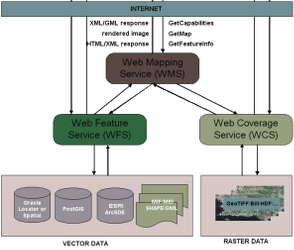
Geoservices, also known as geodata services or OpenGIS Web Services (OWS), are networkable, spatial web services that make geodata accessible in a structured form. Geoservices play a central role in a geodata infrastructure because they are the link to the geodata in their numerous data models and formats. Only through the use of geoservices is interoperable use for a wide variety of network-based geo applications and geoinformation systems (GIS) possible.
OGC web services (WMS, WFS, INSPIRE View Service, INSPIRE Downloadservices)
OGC web services are standardized geodata services. Standardization is carried out with the technical documents of the Open Geospatial Consortium (OGC). These specifications are in turn based on the ISO 19100 series of standards, processed by ISO TC 211.
Data from the National Administration can be used via the following (fee-based) services:
- WFS, Web Feature Service
- Web Map Service, tiled as Web Map Tile Service WMTS
For testing purposes, the Civil Engineering and Geoinformation Office offers a freely accessible test service. You can find the test service here
Transformation services
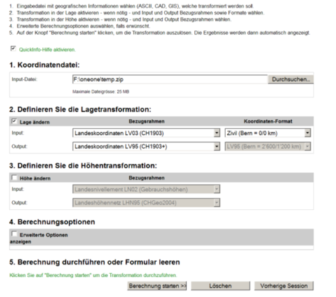
Transformation services are services that make it possible to transform geodata to specific formats, specific data models or specific reference frames and thus make them usable for your own applications. The Civil Engineering and Geoinformation Office works together with the Federal Office of Topography for coordinate transformation. You can also use the online computing service from swisstopo to transform data with Liechenstein coordinates
Check and validation services
Check or validation services are Internet services that can be used to check data sets for their conformity with data models and standards.
- Check service of the official cadastral survey
The Civil Engineering and Geoinformation Office operates a check service for official surveying data. This service is used to check whether the specified structure and the conditions defined in the associated data model DM.01 are complied with for the respective data set.
Checks carried out are, for example:
- Do the properties map the perimeter of the municipality, without overlaps and without holes
- Is an address assigned to an area that is not a building
- Are all plots labeled on the plan


