Official surveying interface
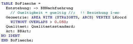
The cadastral surveying data model is described in the standardized and system-neutral data description language INTERLIS.
The data can also be output at any time in the standardized INTERLIS transfer format and read in again by any IT system that is capable of interpreting INTERLIS. The data description in INTERLIS and the transfer format derived from it together form the Official Surveying Interface (AVS).
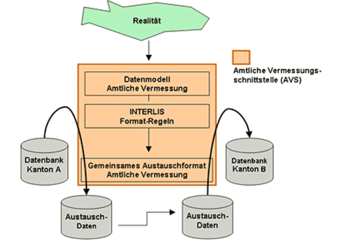
The use of standardized and system-neutral AVS achieves system independence in data management, which guarantees long-term use of official cadastral surveying data that extends beyond the service life of software systems
The Liechtenstein data model is compatible with the Swiss basic data model and, as far as possible, adapted to that of the eastern Swiss cantons.
You can obtain the Interlis description of the Liechtenstein cadastral surveying data model and further information from the Civil Engineering and Geoinformation Office, Division Surveying and Geoinformation, or directly in the section Download guidelines and documents.