Landscape models
Topographic Landscape Model Switzerland (TLM) also in Liechtenstein
The Liechtenstein cadastral survey is based on the Swiss cadastral survey. The Civil Engineering and Geoinformation Office and the Federal Office of Topography swisstopo have concluded a cooperation agreement that obliges swisstopo to create and maintain the national survey in cooperation with the Civil Engineering and Geoinformation Office also on Liechtenstein territory according to the same quality guidelines as in Switzerland. This ensures the availability of high-quality land surveying bases and products on Liechtenstein territory as well.
The topographic landscape model is geodata that describes the shape and land cover of the earth's surface and its nomenclature in three dimensions.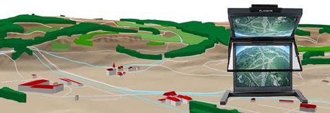
The Civil Engineering and Geoinformation Office and the Federal Office of Topography swisstopo have concluded an agreement that obliges swisstopo to create and maintain the TLM on Liechtenstein territory in accordance with the same quality guidelines as in Switzerland. The Civil Engineering and Geoinformation Office provides swisstopo with the cadastral survey data for the creation of the TLM. In return, the National Administration receives a license for the full use of the TLM. In addition, the Civil Engineering and Geoinformation Office receives the distribution rights for the SWISSIMAGE orthophoto and the SwissALTI3D elevation model within Liechtenstein and for customers from Liechtenstein as part of this agreement.
Online counter
Laws
-
GDI-Gebührenverordnung (GDI-GebV)
brick.linklist.external_link.screenreader
-
Geoinformationsgesetz (GeoIG)
brick.linklist.external_link.screenreader
-
Geoinformationsverordnung (GeoIV)
brick.linklist.external_link.screenreader
-
Vermessungsgesetz, VermG
brick.linklist.external_link.screenreader
-
Vermessungsverordnung, VermV
brick.linklist.external_link.screenreader